Results
CQ Worldwide FOXHUNT weekend
Saturday, May 12, 2012
Silverdale, WA
Last revised: May 23, 2012


| |
Results
|
| |
|
|
|
|
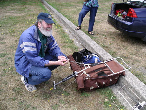
We had beautiful weather with a total of nine participants from
Tacoma, Kitsap, Seattle and Port Angeles. Silverdale is a
new hunt area and was selected for its central location. The
base for fox #1 (Tx #1) was at the South end of Clear Creek
drainage as it enters Dyes inlet; 47° 39.067'N, 122°
41.087'W. Clear
creek extends over 5 miles with many scenic trails in a
close-in urban setting. It turns out to be a nice on-foot
bunny hunt area with many access points.
To reach this location the exercise was set up in two parts;
vehicle then on-foot. You had to find Tx #1 by vehicle first
to establish the starting point for Tx #2 and #3. All the
participants had trouble finding the first Tx. It took
nearly two hours for the fastest. Most have experience with
on-foot hunts so using vehicles is new. I should also
mention that the starting location for the auto hunt was
undefined, you could start from anywhere within the map
boundary. Rich, KR7W pointed out that Tx #1 was very
weak. It turned out, the antenna, which was a mag mount on
the top of my vehicle had a broken connection with high
VSWR. This reduced the available signal and probably
contributed to the difficulties.
All in all everyone seemed satisfied and motivated to plan future
hunts. Follows the prep that went into this one:
This will be a little different, combining a vehicle hunt with the plain old "on-foot" variety. It will be in two parts. I also wanted to change the hunt site to something central for most participants.
RDF (radio Direction Finding) is often used to locate RF interference which requires localization before you start using hand held equipment. The first part requires a vehicle but because of the hazards using a vehicle while trying to obtain bearings, we'll have no time recording and the start location will be from wherever you think is a good spot. Speed on this leg will not be important. You'll be searching for Tx #1 only. Once everyone reaches Tx#1, we'll start together for the second part which will be "on-foot" for Tx #2 and #3.
The first leg will encourage triangulation more than "on-foot" hunts. Gas is expensive so you can team up if their are enough participants with vehicles. Of course, do you trust them with the info they pass on or will they try to send you off on a "wild goose chase"? Note that antenna polarization for Tx #1 will be vertical so Doppler systems would work. But, antennas mounted on a vehicle are not really required. The recommended procedure is to drive to a safe location, park and obtain a bearing by getting out of the vehicle with your regular on-foot equipment. Then plot the results on a map. After you take about three bearings from different locations, you'll begin to zero in on TX #1 location. You're responsible for your own maps and the internet has many options.
All that's needed is your regular gear. Sounds simple, right? We'll see? Never never attempt to take bearings while underway; very dangerous indeed!
Tx #1 will be in a vehicle at a parking lot and this will become
the "start" location for the rest of the hunt (part 2).
Transmitters #2 and #3 will be turned on by remote control around
1200 noon. Everything is "on-foot" from this
point on.
At 1500 we may choose to meet at one of the many food/drink
facilities in Silverdale if participants are up to it?
| Date |
Saturday, May 12, 2012 |
| Starting time/location | Tx #1 will be turned on at 1000. Starting location will not be defined. Your task, should you choose to accept it, will be to find the location of transmitter #1 from your random start location. Once everyone has reached #1 we will start the "on foot" hunt expected at 1200 noon. Transmitter #1 will be located somewhere within the map boundary below. You should be able to receive its signal anywhere but if not, move a little and try again. WA7NBF will monitor the liaison frequency most of the time. Once we near the "part 2" start time, the location of TX #1 will be given in latitude and longitude over the repeater. |
| Transmitter(s)(foxes) | 2 meters. Details below. |
| Type of hunt | Vehicle, then on-foot. A two part hunt. |
| Search Boundary | See map, Silverdale area below |
| Have I found it? | TX #1 will be in vehicle with
license plate: KA7CSZ. For Tx #2-3: ARDF flags will not be
used but a small (2 in) lapel button with a codeword or
phrase will be within 3 feet of antenna. This will
test your "close in sniffing" skills. All you'll need
to record is this codeword. Please leave site as
quickly as possible to reduce help to others and vandals. Please do not attempt to locate the transmitter as it will be well hidden, ..... your looking for the antenna marker. |
| Liaison Frequency | 145.43 Mhz, PL= 179.9 Hz, "-" offset |
| Hazards | Traffic, more urban an area than we're use too. |
| Degree of difficulty | Vehicle: Difficult hunt On-foot: Easy hunt |
| After hunt activity | TBD |
| Prizes | No |
| Registration | Please send me email if you intend on participating: WA7NBF |
Transmitters will be located somewhere within the bounds of this map. Tx #1 signal should be within range for most of this area. Your selection of your initial starting point needs to take this into consideration. Tx #1 will remain operational till 1500 and act as a homing signal back to the start for the "on-foot" portion.
| |
Tx #1 | Tx #2 | Tx #3 |
| Activated | 1000-1500, left operational for the day to act as a homing beacon. | When all participants reach Tx #1 position or 1200 noon.
Deactivated: 1500 |
When all participants reach Tx #1 position or 1200 noon. Deactivated: 1500 |
| Frequency | 146.565 Mhz | 146.565 Mhz | 146.565 Mhz |
| Modulation | FM, female voice ID | FM, male voice ID | FM, male voice ID |
| Duty cycle | 1 min. "on", 2 min "off" | 1 min. "on", 2 min "off" | 1 min. "on", 2 min "off" |
| Synchronized | yes | yes | yes |
| Style | Mag mount on vehicle, 1 1/2 watts | Ammo can, 1 1/2 watt | Ammo can, 1 1/2 watt |
| Antenna Polarization | Vertical |
Horizontal | Horizontal |
| Antenna Geographic ID | Ham license plate on host vehicle, KA7CSZ | lapel button | lapel button |
| Trickery | no | no | no |
| Prize | no | no | no |